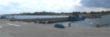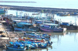

Nagapattinam port (Tamil Nadu-E India)
28nm
357°
23 Mar 12
Jojo
| Latitude | Longitude | |
| DMS | --- | --- |
| DM | --- | --- |
| DD | --- | --- |

")
Ebook | Bay of Bengal
|
 Point Calimere is the southernmost extremity of the Coromandel Coast and the NW entrance point of Palk Strait.
The following conspicuous objects lie in the vicinity of the point:
Between Point Calimere and Madras, there are no charted or known dangers seaward of the 35m curve.
The 120m curve lies about 2 to 16 miles offshore, lying at its greatest distance off the E of Point Calimere.
An 8.7m detached shoal lies about 7.5 miles ENE of Point Calimere. A drying sand bank extends about 2 miles NE of the same point. During bad weather small craft shelter inside this bank.
Nagapattinam Shoal, about 5 miles long and composed of hard sand and stones, lies parallel to the coast about 4 to 5 miles offshore. The N end of this shoal lies about 6.8 miles SE of Nagapattinam Light. Depths over this shoal range from 6.1 to 8.5m.
Several 18.3m patches lie outside the 18m curve, about 12.5 to 17.5 miles NE of Pondicherry Light.
The coast between Point Calimere and Nagapattinam, about 28 miles to the N, is low and fringed by trees. Sand ridges, 3 to 10m high, also fringe the coast.
The E coast of India, from Point Calimere N to Cocanada, is about 500 miles long and is known as the Coromandel Coast. That part of the coast between Cocanada and Balisahi Point, about 364 miles NE, is known as the Orissa Coast.
The low sandy coast fronting the W side of the Bay of Bengal is exposed to a very heavy surf. As a result, there is little or no shelter provided for vessels other than small craft. The harbors at Chennai and Vishakhapatnam are the only large ports providing shelter and berthing facilities for all classes of vessels.
The coast S of Chennai appears to have been encroached upon by the sea to a considerable extent.
Between Pondicherry and Chennai, scattered hills rise to heights of 46 to 198m, at distances of 2 to 16 miles inland.
Similar hills lie in the vicinity of Nellore, and as far N as the Gundlakamma River.
Between Godavari Point and Shortt Island, about 360 miles NE, the coast is low and barren in places and relatively high and densely wooded in other places. With the exception of Cocanada and False Bays, there are no indentations of any appreciable size.
The depth curves generally parallel the coast with the 200m curves lying about 15 to 25 miles offshore between Godavari Point and the mouth of the Devi River.
Changes in the monsoons are usually accompanied by bad weather. Cyclonic storms, although rare, sometimes occur near the middle of November or the beginning of April.
The rainy season commences toward the end of June and ends in the latter part of November.
The direct effect of the Northeast Monsoon and the Southwest Monsoon winds on the surface waters of the Bay of Bengal is the development of seasonal currents in opposite directions.
Along the E coast of India, on the W side of the bay, it is not unusual to experience currents setting with velocities of 2 to 3 knots. From February through May, a strong current sets to the N, and from September through December, a similar current setting to the S may be experienced. A survey party found currents with velocities of 1 to 2 knots outside the 45m curve, less current between the 35 and 18m curves, and little or no current inside the latter curve. Close to the shore, the current was occasionally reversed.
When the current was setting to the N in the offing, a set out of Palk Strait was usually found, and presumably the reverse takes place when the current sets to the S. Tidal currents are experienced close offshore and they vary the strength of the current in the neighborhood of Middle Banks in Palk Strait.