
Ujung Karang (Kareueng) (W Sumatra)
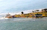
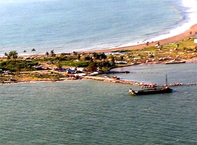
Ujung Kareueng, the W extremity of Meulaboh Bay, is a low point sparsely covered with coconut trees with buildings of a settlement on it; a light is shown from Ujung Kareueng. ...
| Latitude | Longitude | |
| DMS | --- | --- |
| DM | --- | --- |
| DD | --- | --- |


 Meulaboh Bay affords less protection, there being no reefs seaward.
The shore of the bay is fronted by a reef which extends 91m off Kuala Tjangku.
Meulaboh is the capital of W Aceh Regency and is among the hardest hit areas by the 2004 Indian Ocean earthquake. Being just 150 km from the epicenter of the earthquake, Meulaboh was hit by tsunami.
About 2 miles N of Ujung Kareueng a white conical monument stands near the coast.
Meulaboh, situated on the W side of the bay, is the shipping port for copra, pepper, and forest products.
Landing places for boats are available, but is often impossible because of heavy surf.
The tides are inconsiderable, but occasionally rise as much as 0.3m.
A ferry berth, consisting of a Tshaped jetty, lies close S of the town. A quay, 52m in length, with a depth alongside of 1.5m, lies at the head of the bay.
The mooring buoys of an oil depot lie about 1 mile ENE of Ujung Geudong. A submerged oil pipeline extends 0.5 mile NNW from the mooring buoys to the shore.
Anchorage may be obtained, in a depth of about 7.9m, sand and mud, with the flagstaff close NW of Ujung Geudong bearing 268° and the light structure on Ujung Kareueng bearing 229°.
It is exposed to winds between SW and SE, and the holding ground is bad; vessels should be ready to leave at short notice.
A vessel approaching from W can round the reefs off Ujung Kareueng by eye, as they are marked by breakers.
When Ujung Geudong is open to Ujung Kareueng, a vessel may steer for the anchorage, rounding the latter point at a distance of about 1 mile. Approaching from S, the zinc roofs of
Ujung Kareueng are visible from a considerable distance.
Caution.—Several dangers, marked by breakers, lie in theW approach to Meulaboh Bay. A reef, with a least depth of 4m, lies about 2 miles NW of Ujung Kareueng and 0.5 mile offshore.
About 1 mile SSW of this reef is a 4.9m patch.
About 1 mile W of the same point is a 3.3m patch, with a similar patch close N of it. Between these patches and the W side of the peninsula lies a reef with a depth of 2.4m. Depths of about 3m less than charted were reported to exist in the bay E of a line joining Ujung Kareueng and Ujung Geudong.
Tel: +62 655 21279
Fax: +62 655 22190
Mail: pcc@pertamina.com
Anchorage depth: 7,1 m to 9,1 m
Cargo pier depth:1.8m - 3m
Oil terminal depth:1.8m - 3m

Ebook | Andaman sea
|


