Armagon Shoal, with depths ranging from 3 to 9.1m, extends about 15 miles N from a position 1.5 miles NE of Point Pudi. A narrow, detached shoal, about 2.5 miles long, with depths of 10 to 11m, lies close N of the N end of Armagon Shoal. The sea sometimes breaks over the shallowest ...
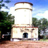
The Lighthouse station is separated from Pulicat town by a sea water channel. The town of Pulicat lies on an island at the S end of Pulicat Lake and is visible from the offing. A tall conspicuous monument lies close N of the lighthouse near the beach. The lighthouse at this ...
Pulicat Shoals, a chain of hard, sandy patches with depths ranging from 4.3 to 9.1m, extends about 7.5 miles NNE from the N end of Ennur Shoal. Several detached patches, with depths of 8.2 to 11m, lie within 3.8 miles N and NNW of the N end of Pulicat Shoals. These shoals were ...
Krishnapatnam or Kistnapatam is a port town in Muthukur mandal of Nellore district in Andhra Pradesh.Krishnapatnam is a major port and market center. It is situated at a distance of 24 km from Nellore City in Nellore District, the southernmost coastal district in the state of ...
Ennur Shoal, with depths of 0.9 to 8.5m, extends 2.5 miles NE from a position on the coast about 10.5 miles NNE of Chennai Harbor. The coast between Chennai and Ennur, about 9.5 miles NNE, is bordered by plantations of casuarina and palm trees.


 Point Pudi, a low sandy point, is marked by clumps of palm trees. Armagon Shoal extends N from Point Pudi.