Pulo Rondo (Aceh - N Sumatra)

Pulo Rondo (Aceh - N Sumatra)

Para ubicar con precisión. Actualizar si es necesario.

Ubicación

Pulo Rondo (Aceh - N Sumatra)
LatitudeLongitude
DMS------
DM------
DD------

Característica

Anclaje
Arena
Faro
Buceo

Descripción

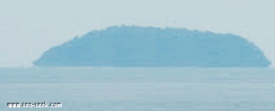
Pulau Rondo is the northwesternmost of the islands lying off Ujung Masam Muka, the NW point of Sumatera, about 15 NM NW of Beueh island.

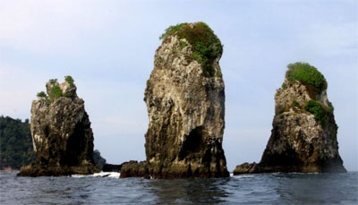
The island is 153m high, wooded, steep-to on its N side, and about 30 miles offshore. It  appears from all sides as a flattened half sphere. Rocky islets lie on a reef which extends about 1 mile S from the islands SW side and is steep-to on its outer edge. Ocean-going vessels bound E pass N of Pulau Rondo.

The island is inhabited and is sometimes visited by scuba divers. There is also a small Indonesian military outpost on the island. Accessible only boat.

An off-lying bank, with a least depth of 51m, coral rock and sand, lies with its center located about 13 miles NW of Pulau Rondo.

Anchorage may be obtained, in a depth of about 14m, during the Northeast Monsoon, with the SW extremity of Pulau Rondo bearing 103° and the NW extremity bearing 044°.
There are strong tide rips off the island and up to 20 miles WNW.
2012/01/10
Actualizar
Jojo
Pulo Rondo (Aceh - N Sumatra)
2012-01-10
Actualizar
Jojo
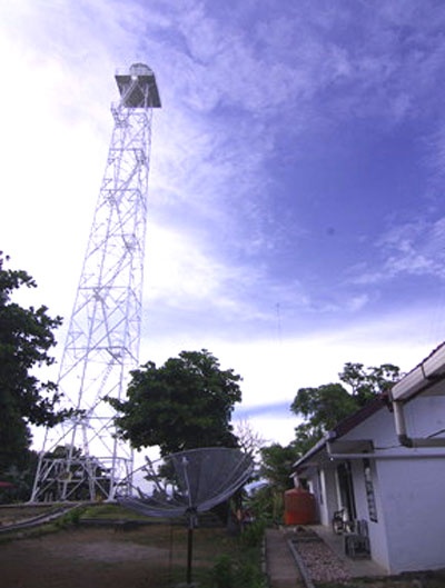
Pulau Rondo has askeletal tower with lantern and gallery, painted white.
2012/01/10
Actualizar
Jojo
Pulo Rondo (Aceh - N Sumatra)
Rondo spot
2012-01-10
Actualizar
Jojo
Pulo Rondo (Aceh - N Sumatra)
Pulau Rondo lighthouse
2012-01-10
Actualizar
Jojo
Ebook

Andaman sea

  • 177 sites
  • 162 photos
  • publication date: 8 Aug 2024
  • .pdf file size: 58 Mb
Comparta sus comentarios o fotos en "Pulo Rondo (Aceh - N Sumatra)"

Sitios alrededor de Pulo Rondo (Aceh - N Sumatra)

Flying distances - Direct line

Pulau Peunasoe (Nasi) (SE Breueh)

27nm
174°
Pulau Nasi (Peunasoe or Aceh island), nearly joins the SE point of Pulau Breueh, being separated by Aroih Lam Puyang.
The coast line is rocky in places with sandy beaches chiefly on the W side.
11 Jan 12
Jojo

Lhok Prialaut (N Weh)

16nm
143°
Lhok Prialaut is the bay lying between Ug Bau and Ug Seukundo. 6,5 NM appart, between wich points the bay extends S for about 4 NM, with Teluk Sabang on its E shore.
Lhok Prialaut is about 2 miles in length and breadth, with good anchorage near its head, in 16.5 to 21.9m.
Tides—Currents.—The ...
15 Jan 12
Jojo

Ujung Bau (NW Weh)

12nm
149°
Ujung Bau, the NW extremity of Pulau We descends from the mountain to the sea. A rock, over which there is very little water, is reported to lie about 0.3 mile off the W coast in the vicinity of Ujung Bau.
13 Jan 12
Jojo

Pulau Rubiah (N Weh)

14nm
144°
Pulau Rubiah is a small island, nearly 0,9 mile in lengt, in a NW and SSE  direction, consist of small wooded hillocks, the highest being 40 m in height.
15 Jan 12
Jojo

Ujung Batumeurunrung (N Weh)

15nm
143°
Ug Batumeurunrung, the E extremity of the bight in wich Pulau Rubiah is located, has above-water rocks on the reef which extends about 0.1 mile NNE.
15 Jan 12
Jojo

Pulau Keureuse (SW Breueh)

26nm
185°
Pulau Keureuse (Nasi Kecil) or pulau Teunom, lies about 0.6 mile off the SW end of Pulau Breueh.
A sand bank, with depths of less than 5.5m, extends NE for a distance of about 0.3 mile from the NE coast.
11 Jan 12
Jojo