Tanjung Percudian is fringed by mangroves and may be easily identified by the high trees behind it, decreasing very rapidly in elevation upon closer approach.
Panipahan Village stands 4 miles S of this point.
Between Panipahan Village and the entrance of the Sungai Rokan, about 27 miles SE, the coast is broken by several creeks and bordered by shoals.
Between Tanjung Pertandangan and Tanjung Sinaboi, about 56 miles ESE, the only points of identification are the river mouths. The mangrove covered coast is mostly muddy and low lying. The coastal bank, as far out as the 10m curve, is marked by fishing stakes and enclosures. Fishing ...
Pyramid Shoal, which lies on the N side of the SE end of South Sands, has a least depth of 3.4m, hard sand, and is the most dangerous shoal in the area because of its depth and protrusion into the fairway. A lighted buoy is moored about 7 miles SE of Pyramid Shoal. A depth of about ...
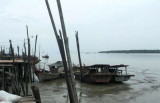
Pulau Alang Besar, or Pulau Halang as it is also referred to, is
situated off the eastern coast of Sumatra in Riau Province, Pabupaten
Bengkalis. The island and associated coastline lie at Kuala Rokan.This small mangrove island and the nearby coastline contain extensive
habitats ...
The coast between Tanjung Jumpul and Tanjung Siapiapi, about 9 miles SE, is bordered by a mudbank with depths of less than 1.8m. This bank extends up to 5.75 miles off the former point and 2.5 miles off the latter point. There are some fishing huts but few objects for identifying ...
Tanjung Sinaboi, low and thickly wooded, is the NE extremity of the peninsula separating theSungai Rokan from Selat Rupat. Pulau Sinaboi, a small lightcolored islet, lies close NW of Tanjung Sinaboi and shows up well against the darker growth of the mainland.
The Sungai Asahan is entered between Tanjung Napal, 10 miles SE of Tanjung Tambuntulang, and Tanjung Jumpul, about 2 miles to the SE. These points and the coast in the vicinity are low, muddy and overgrown with mangroves. The channel is marked by buoys and beacons. Jumpul ...


 Tanjung Percudian is fringed by mangroves and may be easily identified by the high trees behind it, decreasing very rapidly in elevation upon closer approach.