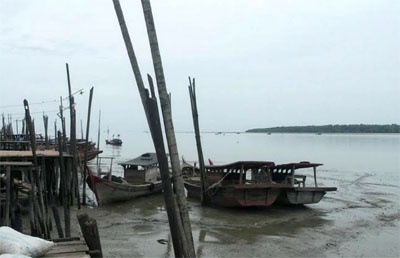
Tanjung Siapiapi (E Sumatra)
There are some fishing huts but few objects for identifying ...
| Latitude | Longitude | |
| DMS | --- | --- |
| DM | --- | --- |
| DD | --- | --- |

 The Sungai Asahan is entered between Tanjung Napal, 10 miles SE of Tanjung Tambuntulang, and Tanjung Jumpul, about 2 miles to the SE.
The channel is marked by buoys and beacons.
Jumpul Bank extends about 7 miles N from Tanjung Jumpul to the 10m curve. The bank dries up to 2 miles N from the point. The NE and E edges of the bank are steep-to. From the SE, the bank can be picked up by soundings but not from the NW. Fishing enclosures are erected on the bank.
The channel in the approach to the river runs along the edge of the drying bank extending offshore NW of Tanjung Napal and has a least depth of 0.6m on the bar.
Above Baganasahan about 2 miles S of Tanjung Napal, the least depth in the channel to the wharf at Teluk Nibung is about 0.9m at LW and 4m at HWS.
Springs rise about 3m and neaps about 1m. Outside the bar the flood sets from SE to SSE at a rate of about 1.5 knots and the ebb NNW, but more to the N, at a rate of about 2 knots.
During neaps, the currents are weak and irregular and overcome by the river current. Near the outer buoy, the ebb sets NW and the flood sets SE.
The flood begins in the entrance about 5 hours before HW; the ebb begins about 6 hours later. The flood attains a rate of 1.5 knots and the ebb a rate of 3 knots at springs. During freshets, the rate is increased on the ebb.
A vessel approaching the Sungai Asahan should obtain an accurate fix by the bearings of The Brothers and Tanjung Tambuntulang, and then steer for the outer bar buoy.
The channels are continually changing, only vessels with local knowledge should attempt to enter the river.

Ebook | Sumatra (Indonesia)
|


