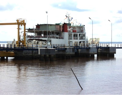
Selat Lalang (E Sumatra)
In Selat Lalang and Selat Pandjang ...
| Latitude | Longitude | |
| DMS | --- | --- |
| DM | --- | --- |
| DD | --- | --- |


 Sungaipakning stands about 2 miles S of Tanjung Balaidalam. It's a small port.
A shoal, with a least charted depth of 8m, extends about 3miles SE from a point about 1 mile NE of the charted light in position 1°20.7'N, 102°09.5'E.
A shoal, with a least charted depth of 8m, extends about 3 miles SE from a point about 1 mile NE of the charted light in position 1°20.7'N, 102°09.5'E.
Wharf No. 1, reported capable of accommodating tankers up to 259m in length, with a depth of 14.5m alongside, extends from the shore at Sungaipakning.
The T-head is 305m and is connected to the shore by a long causeway, 213m in length.
Wharf No. 2, which stands 0.5 mile S of Wharf No. 1, has a central platform 55m in length and 12m wide. The wharf is capable of handling two tankers simultaneously, but vessels up to 85,000 dwt have been successively loaded alongside.
The wharf is flanked by two large mooring dolphins; the outer dolphins are detached but the inner dolphins are connected to the loading platform by catwalks.
The harbor pilot boards in the anchorage area.
The recommended anchorage lies about 1 mile NNE of Wharf No. 1, in depths of 20 to 40m, clay, good holding ground, but mariners are cautioned that the tidal currents are strong.
Caution: The wreck of the M/V Lestari Permai is reported (2005) to lie 1.5 miles E of Sungaipakning and S of the charted anchorage area.

Ebook | Sumatra (Indonesia)
|


