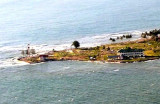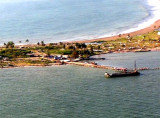

Ujung Karang (Kareueng) (W Sumatra)
Ujung Kareueng, the W extremity of Meulaboh Bay, is a low point sparsely covered with coconut trees with buildings of a settlement on it; a light is shown from Ujung Kareueng. ...
| Latitude | Longitude | |
| DMS | --- | --- |
| DM | --- | --- |
| DD | --- | --- |

 Between Meulaboh and Ujung Raja, about 34 miles SE, the coast is low, with high trees behind. There are no off-lying dangers until about 12 miles SW of Ujung Raja and the soundings give good warning of approach to the coast.
The mountains lie far inland and are only visible in the early morning.
From a position about 13 miles SW of Ujung Raja to a position about 4 miles W of Tapa Toean (3°15'N., 97°11'E.), a distance of about 50 miles SE there are many shoal patches with depths of from 7.6 to 12.8m close inside the 200m curve, and then to the coast there are numerous patches with even lesser depths reported.
Those reefs off the coast between Ujung Raja and Ujung Brang Bang are seldom marked by breakers or discoloration.
Caution.—There are several islands off this coast; numerous isolated dangers, many out of sight of land, which make navigation hazardous.
The nature of the bottom changes completely S of Ujung Raja, whereas to the N, the depths decrease regularly. A vessel may come suddenly into considerable and irregular depths S, which will be close to dangerous shoals.
Soundings, however, should not be neglected, and a good lookout aloft should always be kept during the day. Night navigation is attended with considerable risk.
Ebook | Andaman sea
|


