
Isla Santa Maria (Antofagasta N Chile)
Des rochers s'étendent à un peu plus de 0,5 MN vers le SSW à partir du côté S de l'île et à plus de 0,3 MN de tous les autres côtés.
| Latitude | Longitude | |
| DMS | --- | --- |
| DM | --- | --- |
| DD | --- | --- |


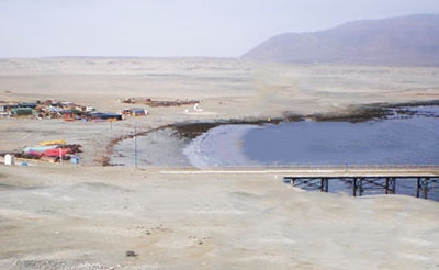
 Caleta Constitucion se trouve au NE de l'île Santa Maria.
 Un chenal, d'environ 180 m de large dans sa partie la plus étroite, avec une profondeur de 11,9 m, se trouve au S entre l'île Santa Maria et le continent et relie cala Constitucion à Caleta Errazuriz.
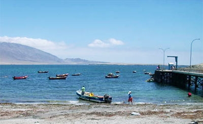
On peut ancrer dans l'anse, au NE de Isla Santa Maria et le continent. Le meilleur mouillage se trouve à environ 0,5 MN à l'ENE de l'extrémité N de l'île, par 11 à 18,3 m.
Attention la brise de terre, appelée "paracas", est quelquefois forte, notamment la nuit.
 Caleta Constitucion
 Caleta Constitucion is entered NE of isla Santa Maria.
A channel, about 180 m wide at its narrowest part and with a depth of 11.9 m, trends S between Isla Santa Maria and the mainland and connects Caleta Constitucion and Caleta Errazuriz.
We can anchor in the cove, NE of Isla Santa Maria and the mainland. The best anchorage is at about 0,5 NM ENE of the N end of the island, in 11 to 18.3m.
Beware, the land breeze, called "paracas", is sometimes strong, especially at night.
 Caleta Constitucion
Ebook | Chile
|


