Ennore port (E India)

Ennore port (E India)

Per individuare con precisione. Aggiornare se necessario.

Localizzazione

Ennore port (E India)
LatitudeLongitude
DMS------
DM------
DD------

Caratteristica

Porto
VHF Channel 16, 74, 77
Cantiere navale

Descrizione

Ennore Port, about 24 km north of Chennai Port, is  the first port in India which is a public company.
Ennore Port lies on the northeastern corner of the state of Tamil Nadu on a flat coastal plain known as the Eastern Coastal Plains, on the Coromandel coast.

Depths—Limitations

The port has two breakwaters; North Breakwater is 3,080m long while South Breakwater is 1,080m long. The entrance channel, about 3,750m long and 250m wide, is dredged to a depth of 16m. The harbor basin is dredged to a depth of 15m and consists of two 280m long coal berths.
One berth can accommodate vessels up to 65,000 dwt; the other berth can accommodate vessels up to 77,000 dwt.

Pilotage

Pilotage is compulsory. The pilot boards about 0.1 mile S of Fairway Lighted Buoy (13°12.9'N., 80°22.4'E.).

Regulations

Vessels should report their ETA to Ennore Port Control 48 hours, 24 hours, and 3 hours in advance. Any changes of more than 2 hours should be immediately reported.
Vessels should also contact Ennore Port Control 3 hours prior to entering or leaving the harbor.

The ETA message should contain the following information:
1. Vessel’s name, call sign, grt, nrt, dwt, loa, and beam.
2. Draft forward and aft.
3. Cargo grade and quantity on board.
4. ETA at Fairway Lighted Buoy (in local time).
5. Local agent.

Contact Information

Tel: 91 44 2521666
Fax: 91-44-25251665
Mail: marine@ennoreportltd.com

2012/03/26
Aggiornare
Jojo
Ennore port (E India)
2012-03-26
Aggiornare
Jojo
Ennore port (E India)
2012-03-26
Aggiornare
Jojo
Ebook

Bay of Bengal

  • 110 sites
  • 82 photos
  • publication date: 15 Jul 2024
  • .pdf file size: 55 Mb
Ennore port (E India)
brajendra251518@gmail.com
2020-07-28
Aggiornare
Anonymous
Condividi i tuoi commenti o le foto su "Ennore port (E India)"

Siti intorno a Ennore port (E India)

Flying distances - Direct line

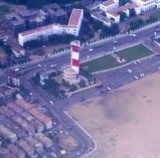
Ennur shoal (E India)

1.4nm
15°
Ennur Shoal, with depths of 0.9 to 8.5m, extends 2.5 miles NE from a position on the coast about 10.5 miles NNE of Chennai Harbor. The coast between Chennai and Ennur, about 9.5 miles NNE, is bordered by plantations of casuarina and palm trees.
26 Mar 12
Jojo

Pulicat Shoals (E India)

6.3nm
Pulicat Shoals, a chain of hard, sandy patches with depths ranging from 4.3 to 9.1m, extends about 7.5 miles NNE from the N end of Ennur Shoal.
Several detached patches, with depths of 8.2 to 11m, lie within 3.8 miles N and NNW of the N end of Pulicat Shoals.
These shoals were ...
26 Mar 12
Jojo

Pulicat lighthouse (Tamil Nadu-E India)

9.6nm
352°
The Lighthouse station is separated from Pulicat town by a sea water channel.
The town of Pulicat lies on an island at the S end of Pulicat Lake and is visible from the offing. A tall conspicuous monument lies close N of the lighthouse near the beach.
The lighthouse at this ...
28 Mar 12
Jojo

Chennai (Madras) port (E India)

9.7nm
194°
Chennai Port,  formerly known as Madras Port, is the second largest port of India, behind the Mumbai Port, and the largest port in the Bay of Bengal and the principal harbor of Coromandel coast. It is an artificial and all-weather port with wet docks that front s the center ...
11 Jul 12
AB

Chennai lighthouse (E India)

13nm
196°
The Madras Light House is a lighthouse facing the Bay of Bengal. It is a famous landmark on the Marina Beach in Chennai. The lighthouse was opened in January 1977. It is one of the few lighthouses in the world and the only one in India with an elevator.
The currents N of Chennai ...
26 Mar 12
Jojo