Haladi river (W India)

Haladi river (W India)

Per individuare con precisione. Aggiornare se necessario.

Localizzazione

Haladi river (W India)
LatitudeLongitude
DMS------
DM------
DD------

Caratteristica

Porto
Relitto

Descrizione

Coondapoor (Kundapur) is an open roadstead off the common entrance of the Haladi River and the Chakranadi River.
The coast N of the river entrance consists of low hills up to about 37m high. The coast S of the entrance is flat, sandy, and fringed with coconut trees up to 24m high.

A wreck, best seen on the chart, lies almost 4 miles W of the harbor entrance.

A shoal patch of 7.4m lies 2.1 miles W of Coondapoor Light.

Foul ground, with rocks above and below-water, extends for about 3.5 miles N of the entrance to Coondapoor to a distance of about 1.3 miles offshore.

Pate Rock, which dries about 1m, lies at the SW edge of this foul area.
A rock, 4m high, lies about 0.2 mile NE of Pate Rock.
A 4.6m patch and a 4.9m patch lie about 0.3 mile SSE and SE, respectively, of Pate Rock. Gangoli Shoals, with a least depth of 5.2m, lie about 3.5 miles WNW of the port entrance.
A 6m shoal lies about 2.8 miles WSW of the entrance. It is marked W by a red and white striped barrel buoy from October to May.
A 6m depth and a 7m depth lie about 1 mile NW and 1.5 miles WNW of the 6m shoal.

The bar across the entrance to Coondapoor had a least depth of 2.5, and is constantly changing.
Steering for the entrance, bearing 055°, leads over the bar in the deepest water. A dangerous wreck lies 3.8 miles W of the harbor entrance. Another wreck lies about 1.5 miles S of the above wreck.

The port is normally closed during the Southwest Monsoon, usually from the middle of May until the middle of September, depending on the weather conditions.

The lighted buoys marking the bar and the channel are removed during this time period.
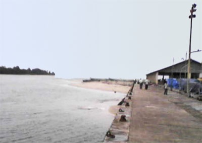
2012/03/12
Aggiornare
Jojo
Haladi river  (W India)
Haladi river port
2012-03-12
Aggiornare
Jojo
Ebook

Arabian Sea

  • 132 sites
  • 73 photos
  • publication date: 7 Aug 2024
  • .pdf file size: 49 Mb
Condividi i tuoi commenti o le foto su "Haladi river (W India)"

Siti intorno a Haladi river (W India)

Flying distances - Direct line

Saint Mary Isles (W India)

16nm
179°
The coast between Coondapoor and Malpe, about 17.5 miles S, is fringed by coconut trees and broken only by the mouth of the Sita Nadi River. The Saint Mary Isles consist of Coconut Island, Middle Rock, Entrance Rock, and the Darya Bahadurgarh Islands.Passage between the islands is ...
12 Mar 12
Jojo

Tippu Sultan Gudda Light (W India)

0.1nm
295°
Tippu Sultan Gudda Light is shown from September 15 to May 15, about 1.5 miles NNW of the Haladi River entrance. Two conspicuous objects are a white house is close NE and a gray chimney, 40m high, 1 mile E of the entrance of the river.
12 Mar 12
Jojo

Coondapoor Light (W India)

0.3nm
160°
Coondapoor Light is shown from a steel mast, about 0.8 mile S of the entrance, from September 16 to May 15. It is difficult to distinguish from other white lights nearby.
12 Mar 12
Jojo

Coconut Island (St mary's Islands-W India)

15nm
178°
Coconut Island, about 2.5 miles NW of Malpe, is well-wooded, with trees about 26m high. Foul ground surrounds the island and extends about 0.8 mile WNW to a rock which dries 2m. A rock, 2m high, lies about 2 miles NW of the island and a chain of rocks, above and below-water, extend ...
12 Mar 12
Jojo

Black rocks Two Rocks Outer Rocks (W India)

21nm
176°
The coast between Malpe and New Mangalore, about 26 miles SSE, is straight and fringed with coconut trees.
Black Rocks, 13m high and conspicuous, lie about 4 miles S of Malpe.
Two rocks, 3m high, and two rocks, 5m high, lie about 0.5 mile NW and 0.2 mile WSW, respectively, of ...
13 Mar 12
Jojo

Nancowry Rock (W India)

10nm
336°
Nancowry Rock consists of two rocky shoals; the W shoal has a depth of 3m. A rock, 3m high, lies between Nancowry Rock and the coast.
10 Mar 12
Jojo