Pulau Senau (N Nias)

Pulau Senau (N Nias)

Per individuare con precisione. Aggiornare se necessario.

Localizzazione

Pulau Senau (N Nias)
LatitudeLongitude
DMS------
DM------
DD------

Caratteristica

Isola / Atoll

Descrizione

From Pulau Senau, lying about 11 miles ENE of Tanjung Tojolawa, the coast is completely exposed to N and NW squalls.
They are prevalent here during the months of October, November, and the first part of December; they may be exceptionally heavy and cause a heavy swell and much sea.

During the Southwest Monsoon, anchorages off this coast, as far W as Pulau Senau, are impracticable because of heavy seas.

When anchoring on the N coast of Pulau Nias, swarms of mosquitoes are blown on board at night with the land breeze, and in view of the prevailing malaria it is advisable to anchor as far as possible offshore.

2012/02/4
Aggiornare
Jojo
Ebook

Sumatra (Indonesia)

  • 326 sites
  • 109 photos
  • publication date: 23 Jul 2024
  • .pdf file size: 109 Mb
Condividi i tuoi commenti o le foto su "Pulau Senau (N Nias)"

Siti intorno a Pulau Senau (N Nias)

Flying distances - Direct line

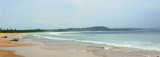
Pulau Wunga (W Nias)

17nm
211°
Pulau Wunga, about 8 NM S of Pulau Mausi, is low andcovered with coconut trees.
A large conspicuous tree, visible for 16 miles, is located on a small elevationnear the N end.
The reef extending from the N side of the island is ordinarily marked by high rollers; on the S side ...
6 Feb 12
Jojo

Pulau Mausi (W Nias)

10nm
232°
Pulau Mausi, low and barren, lies in the S approach to Labuan Atjeh, about 2.2 miles SE of Tanjung Sosilutte.
It has a white sandy beach, and is fringed by a reef onwhich the sea always breaks, extending about 1 mile S; there is a depth of 7.7m at the outer end of the reef.
 An ...
6 Feb 12
Jojo

Tanjung Ginigini (Siginingini) (N Nias)

7.5nm
54°
The N coast of Pulau Nias, which forms the S side of Pulau Nias North Channel, is low, but there is a range of hills extending S from Tanjung Siginingini, the N extremity of the island, to Maziaja Mountain.
4 Feb 12
Jojo

Teluk Siaba

9.6nm
72°
Teluk Siaba, the N anchorage of Pulau Nias, is entered W of Tanjung Dowi. There are two inlets on its W side.
Anchorage may be obtained in Teluk Siaba, in depths of 29m to 40m, giving some shelter from N or W winds.
6 Feb 12
Jojo

Pulau Sarangbaung (W Sumatra)

18nm
39°
Pulau Sarangbaung lies 10.5 miles NNE of the N extremity of Pulau Nias. There is a break in the reef on the SE side where boats can land at a village. The island is overgrown with coconuts and is visible for 12 miles.
4 Feb 12
Jojo

Labuan Aceh (W Nias)

9.8nm
247°
Labuan Atjeh, on the E side of the peninsula, affords sheltered anchorage during N winds, in depths of from 18.3 to 21.9m, sand.
A 1.2m patch lies on the E side of the bay, about 0.3 mile offshore.
6 Feb 12
Jojo