Tanjung Uban port (W Bintan)

Tanjung Uban port (W Bintan)

Per individuare con precisione. Aggiornare se necessario.

Localizzazione

Caratteristica

Porto commerciale
Base navale

Descrizione

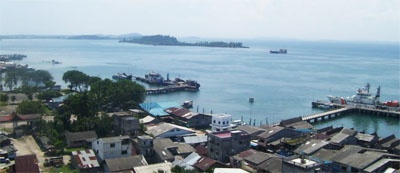
Tanjung Uban (Tanjunguban) is situated on the W coast of Pulau Bintan at the N entrance of Selat Riau.
Tanjung Uban is primarily an oil terminal for trans-shipping oil owned by P. T. Stanvac Indonesia.
There are six T-headed berths which accommodate vessels up to 243m in length. These jetties, numbered 1 through 6 from the N, vary in length. Jetty 1 and Jetty 2 can handle LPG products and have 17.4 and 11.7m alongside, respectively.
The naval base at Mentigi, S of the above berths, comprises two jetties, each 100m in length, and lying perpendicular to the shoreline.
Some oil tanks, with a boiler house, stand close N of Tanjung. Three tall chimneys are plainly visible when approaching from either N or S; radio masts stand about 0.5 mile S of the chimneys.
An unofficial light is shown from the head of each of the petroleum piers at Tanjung Uban.

A beacon, with a red cylindrical topmark, stands on the shore reef about 1 mile N of Tanjung Uban.

Pilotage for berthing is reported to be compulsory for all vessels.
Advanced notice of 72 hours must be given. Vessels berth between the hours of 0600 and 1800 and unberth at any time.

The pilot boards 1.25 miles SW of the S pier. For vessels arriving from the N the pilot boards in position 1°15.1'N, 104°12.0'E.

Caution is necessary when docking at Tanjung Uban as a reef lies parallel to the dock, and an undercurrent frequently sets in the opposite direction to the main surface current.

Tel: 62 771 81064
Fax: 62 771 483454
Channel depth: 11 m
Anchorage depth: 23,2 m
Cargo pier depth: 18,6 m
Terminal depth: 18,6 m

The current runs at the rate of about 5 knots in the channel in the vicinity of Tanjung Uban, and about 2 to 5 knots at the berths at the loading station.
2012/02/24
Aggiornare
Jojo
Tanjung Uban port (W Bintan)
2012-02-24
Aggiornare
Jojo
Ebook

Sumatra (Indonesia)

  • 326 sites
  • 109 photos
  • publication date: 7 Aug 2024
  • .pdf file size: 109 Mb
Condividi i tuoi commenti o le foto su "Tanjung Uban port (W Bintan)"

Siti intorno a Tanjung Uban port (W Bintan)

Flying distances - Direct line

Pulau Pelanduk Subang Mas and Airradja (Indonesia)

7.9nm
198°
Pulau Pelanduk Subang Mas lies about 2 miles NW of Pulau Cemara.Pulau Airradja (Airaja), lies close N and is separated by a narrow drying channel at LW. It is the northernmost of the islands lying between Pulau Cemara and the E entrance of Selat Bulan.Both these islands are hilly ...
15 Feb 12
Jojo

Pulau Tekong

22nm
333°
Petite île à l'extrémité Est de singapore, très proche de la Malaisie. Elle est réservée a des activités militaires.
17 May 11
Wikiadmin2

Selanga Islets and Alor Islands (Indonesia)

34nm
173°
The Selanga Islets, three in number, lying on the SE of Selat Pengelap, are small but elevated and conspicuous; the S islet is 35m high. With an opposing wind and current, a troublesome sea may arise in this area.The Pangelap group of islands separates Selat Pangelap from Selat Abang. ...
29 Feb 12
Jojo

Pulau Tandjungsau (Indonesia)

2.8nm
240°
Pulau Tandjung Sau (Tanjungsau) (Tandjoeng Saoe) lies close N of Pulau Ngenang; a hill rises to a height of 70m about 1 mile WNW of its E end.
A reef of coral and sand, S of the island's E end, fronts the shore to a distance of 0.2 to 0.3 mile; its S portion forms the N side of ...
15 Feb 12
Jojo

Pulau Karas Besar and Karas Kecil (Indonesia)

21nm
159°
Pulau Karas Br, lying about 4 miles N of Korek Rapat, is 3.5 miles long and about 0.7 mile wide; it is hilly, with a flat summit, wooded, and has a reef encircling it extending in places for a distance of 0.25 mile.Pulau Karas-Ketjil (Karas-Kecil), an island marking the SW end of ...
14 Feb 12
Jojo

Pulau Nginang (Indonesia)

4.3nm
216°
Pulau Nginang, a hilly island, located about 2 miles N of Pulau Airradja, with Selat Bulan between, is about 3 miles long, N and S, tapering to the N.
A reef fringes the S and E sides of the island, extending to a distance of 0.25 mile.
15 Feb 12
Jojo