
| Latitude | Longitude | |
| DMS | --- | --- |
| DM | --- | --- |
| DD | --- | --- |

 Bhatkal Fort, in ruins, lies on a rocky point, 46m high, at the entrance to the Bhatkal River.
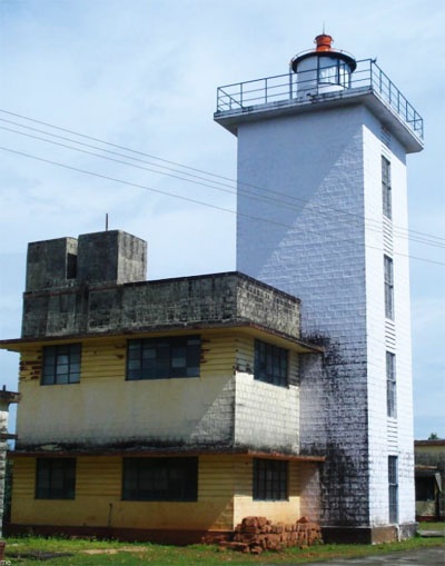
Bhatkal Light is shown from a square masonry tower with red bands on the fort, and is obscured by Shirali on bearings between 129° and 132°.
The town of Bhatkal lies on the N bank of the river, about 1.5 miles NE of the fort.
The channel over the river bar is very narrow and dangerous for ship’s boats.
Anchorage may be obtained, in 10m, with Bhatkal Light bearing 075°, distant 1 mile. Small vessels may anchor, in 7m, sand and shell, with Bhatkal Light bearing 014°, distant 0.3 mile.
Caution.—When approaching from the S, pass W of a 3m rocky shoal which lies about 1 mile SW of Bhatkal Light . Take care to avoid other rocky patches in the approach to Bhatkal, including two 5m patches and a 4m patch which lie about 1.3 miles WSW, 1 mile S, and 0.8 mile W, respectively, of Bhatkal Light.
When approaching from the N, keep the summit of Shirali bearing not less than 006°, and alter course for the anchorage when Bhatkal Light bears 090°.

Ebook | Arabian Sea
|


