Just outside of Mortorio island (at 0,5 NM from Mortorio island) is the rock Mortoriotto, 77 m high, formed by two blocks of granite, the outermost, characterized by the presence of a fire.
The bottom descends to debris at several levels, at 40 m, scattered rocks and coral reef formations. The upper part of the relief is characterized by the channel that separates the two rocks emerging.
2012/09/18
Update
Joëlle
Juste à l'extérieur de l'île Mortorio (0,5 MN NE de l'île Mortorio) se trouve le rocher de Mortoriotto, de 77 m de haut, formé par deux blocs de granit, le plus à l'extérieur, caractérisé par la présence d'un feu.
Le fond descend jusqu'à un débris de fond à plusieurs niveaux, à 40 m, de rochers épars et de formations de récifs coralliens. La partie supérieure du relief est caractérisée par le canal qui sépare les deux rochers émergents.
2012/09/18
Update
Joëlle
Appena all'esterno dell'isola Mortorio (0,5 MN NE dell'isola Mortorio) si trova lo scoglio di Mortoriotto, alto da 77 m, formato da due emergenze di granito, la più esterna caratterizzata dalla presenza di un fanale.
Il fondale degrada a balze fino ad un fondo detritico a 40 m con massi
sparsi e formazioni di coralligeno. La parte alta del rilievo è
caratterizzata dal canale che separa i due scogli emergenti.
Tavolara island is a limestone massif 6 kilometres long and 500 m wide, and 565 m high.The overhanging cliffs make it inaccessible, with the exception of a bay and a beach that is located at each end of the island, Spalmatore di Fuori northeast (military zone) and Spalmatore di Terra ...
Degli Aranci gulf is is bounded, on the N, by the peninsula of which Capo Figari is the E extremity.This gulf is sheltered from NE and NW winds. Strong SE winds send in a heavy sea and storms from the N and E cause a considerable swell in the gulf. During offshore winds, which are ...
Gulf of Arzachena (Arsachena), located between Punta Saline and Tre Monti Cape, is a high inlet whose banks are lined with shoals. S tip, Arzachena, W of the entrance, a beacon consists of an iron post with a sheer spherical white marks a rock particularly ...
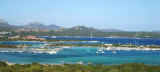
It is the largest island of the archipelago composed of sixty islets and 7 major islands, in the NE end tip of Sardinia. It is mountainous and arid. This is the only inhabited island thoroughly. It is connected by a bridge to Caprera island where are the house and the tomb of Garibaldi. ...
This gulf is S Cugnana gulf, S cala della Volpe. It is entered between Punta della Volpe and Punta Canigione.This gulf is the most protected area of the coast. Although the anchorage is prohibited in the Gulf because of submarine telegraph cables, many boaters anchor in this ...


 Just outside of Mortorio island (at 0,5 NM from Mortorio island) is the rock Mortoriotto, 77 m high, formed by two blocks of granite, the outermost, characterized by the presence of a fire.
 Juste à l'extérieur de l'île Mortorio (0,5 MN NE de l'île Mortorio) se trouve le rocher de Mortoriotto, de 77 m de haut, formé par deux blocs de granit, le plus à l'extérieur, caractérisé par la présence d'un feu.
 Appena all'esterno dell'isola Mortorio (0,5 MN NE dell'isola Mortorio) si trova lo scoglio di Mortoriotto, alto da 77 m, formato da due emergenze di granito, la più esterna caratterizzata dalla presenza di un fanale.
")
")