Sungai Udang Port (Malacca - Malaysia)

Sungai Udang Port (Malacca - Malaysia)

To precisely geolocate this site. Update if necessary.

Localisation

Sungai Udang Port (Malacca - Malaysia)
LatitudeLongitude
DMS------
DM------
DD------

Characteristics

Harbour

Description

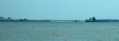
Sungai Udang Port, a T - shaped jetty, is situated about 3 miles NW of Tanjung Keling.

There are seven berths, with alongside depths of 7.2 to 20m, on the seaward side of the jetty; a buoyed channel, dredged to 20m, leads to the four center berths.

Pilotage.—Pilotage is compulsory. Pilots board at Fairway Lighted Buoy or at the anchorage and should be requested, via the agent, 48 hours in advance. The vessel’s ETA should be confirmed 72 hours, 48 hours, 24 hours, and 12 hours before arrival.

Approach.—Vessels approaching Sg. Udang Port should proceed to fairway buoy at position 2( 12'.3 N, 102( 04'.5 E (Long Fs1.W.10s). When proceeding towards fairway buoy:

a) Vessels coming from the north must not enter into Sg. Udang Port limit.

b) Vessel coming from the south must not enter Melaka Port limit.


Caution: Deep draft vessel approaching from the north should avoid a shallow patch of 15.8m at position, Lat 02 14, 2N Long 102 04.0 E approximately 4.5n.m. North West of the pilot boarding ground.

Regulations.—The maximum drafts allowed at each berth are, as follows:
1. Ocean Berth 1—14.9m.
2. Ocean Berth 2—14.9m.
3. LPG berth—6.0m.
4. Bulk Cargo Jetty—5.5m.
5. Coast Berth 1—7.3m.
6. Coast Berth 2—8.1m.
7. Coast Berth 3—8.1m.
8. Coast Berth 4—6.3m.

Tel: 06 3512282
Fax: 06 3517185

Anchorage.—A General Purpose Anchorage has been established 5 miles NW of Tanjung Keling. The depth was reported (2001) to be 19.1m. Other designated anchorage areas include the Ocean Anchorage, Coastal Anchorage, and the eight LPG Anchorages.
2012/01/3
Update
Jojo
Sungai Udang Port (Malacca - Malaysia)
2012-01-03
Update
Jojo
Ebook

Strait of Malacca (East)

  • 83 sites
  • 69 photos
  • publication date: 22 Jul 2024
  • .pdf file size: 36 Mb
Ebook

Sumatra (Indonesia)

  • 326 sites
  • 109 photos
  • publication date: 23 Jul 2024
  • .pdf file size: 109 Mb
Share your comments or photos on "Sungai Udang Port (Malacca - Malaysia)"

Sites around Sungai Udang Port (Malacca - Malaysia)

Flying distances - Direct line

Water islands (Malacca - Malaysia)

15nm
130°
Between Melaka and Tanjong Seginting, about 46 miles SE, the low, thickly wooded coast is bordered by a mud bank which extends up to 2.5 miles offshore in places.
The Water Islands, centered about 8 miles SE of Melaka, consists of a group of six tree-covered islands of moderate ...
5 Jan 12
Jojo

Pyramid shoal (Malaysia)

34nm
288°
Pyramid Shoal, which lies on the N side of the SE end of South Sands, has a least depth of 3.4m, hard sand, and is the most dangerous shoal in the area because of its depth and protrusion into the fairway.
A lighted buoy is moored about 7 miles SE of Pyramid Shoal. A depth of about ...
28 Dec 11
Jojo

Tg Panchor (Malacca - Malaysia)

1.9nm
317°
Tanjong Panchor stands on the coast about 2 miles E of Pulau Batu Besar. Foul ground extends in a general SW direction from Tanjong Panchor for a distance of about 2 miles.
The outermost danger, which has a depth of 3.4m, lies 1.25 miles SW of the point. The passages between these ...
2 Jan 12
Jojo

Pulau Melaka (Malacca - Malaysia)

7.8nm
107°
Malacca island or Pulau Melaka is a man-made island in Malacca town. it's linking to the mainland by a 30 m bridge on a side and has a jetty on the other side.
5 Jan 12
Jojo

Tanjong Keling (Malacca - Malaysia)

2.8nm
132°
Between the S entrance point of the Sungai Linggi and Tanjong Keling, about 15 miles SE, the coast consists of irregular rocky points interspersed with small sandy beaches.
The coast between Tanjong Panchor and Tanjong Keling, about 5 miles SSE, is fringed by a bank of sand with ...
4 Jan 12
Jojo

Pulau Batu Besar (Malacca - Malaysia)

4nm
301°
Pulau Batu Besar, 4.6m high, stands 1.25 miles offshore, 7 miles SE of Batu Tengah. A sandy ridge, with depths of 6.1 to 9.7m, lies from 0.5 to 2 miles NW of the rock.
A shoal with a depth of 16.3m, lies 3.5 miles WSW of Pulau Batu Besar.
Two white towers, each about 34m high, ...
2 Jan 12
Jojo