
Ujung Kupiah (Tapaktuan) (W Sumatra)
0.1nm
207°
The chart should be referred to for the off-lying reefs between the coast and the 200m curve.
4 Feb 12
Jojo
| Latitude | Longitude | |
| DMS | --- | --- |
| DM | --- | --- |
| DD | --- | --- |


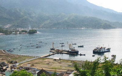
 Tapaktuan, entered between Ujung Kupiah and Ujung Batu Itam, about 2 NM E, is entirely open S.
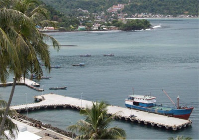
The pier can accommodate vessels up to 5,000 dwt, with a maximum length of 60m and a maximum draft of about 5m, although ships remain in the roads to load and discharge. Cargo is conveyed to and from shore by private barges.
A very prominent house stands among those on the W shore of the bay.
Good anchorage may be obtained, in a great depth of 36m, mud, with the pier head bearing 324° and Ujung Kupiah bearing 270°. The anchorage is uncomfortable with winds between W and S.
Caution.—Batu Tungkat, a rock which dries, lies about 1 mile W of Ujung Kupiah. Batavia Rock, with a depth of 11.9m, lies about 0.3 mile NW of Batu Tungkat. Batu Kupiah, which dries, lies about 0.1 mile SW of Ujung Kupiah, the W entrance point of the bay.


Ebook | Andaman sea
|


