Pulau Wunga (W Nias)
31nm
259°
A large conspicuous tree, visible for 16 miles, is located on a small elevationnear the N end.
The reef extending from the N side of the island is ordinarily marked by high rollers; on the S side ...
6 Feb 12
Jojo
| Latitude | Longitude | |
| DMS | --- | --- |
| DM | --- | --- |
| DD | --- | --- |

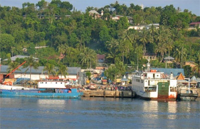
 Gunung Sitoli (Gunungsitoli is the capital and the port of Nias. It is located about 14 NM NW of Tg Lambaru and forms a deep bight.
Gunungsitoli, the chief town of the island, is the seat of government. It lies mainly on the left bank of the river.
The harbor is sheltered from W and SW winds, but to all winds from N and SE it is completely exposed so that considerable swells may result.
It is advisable to anchor, in 40m, mud, about 0.2 mile offshore.
The main jetty, 60m in length, is T-shaped at the head and has a depth of 12m alongside. An L-shaped town pier has a length of 67m and a depth of only 2m alongside. Gunungsitoli
Oil Jetty provides mooring to vessels up to 5,000 dwt with a maximum length of 90m. The berth lies at the head of a 170m long jetty with dolphins off each end. A depth of 9.5m is reported alongside.

Ebook | Sumatra (Indonesia)
|


