Shallinger Shoal, a spit with depths of 3.2 to 4.6m, extends about 2.5 miles NE from the coast, 7.5 miles N of the mouth of the Upputeru River. A detached 5.5m patch lies 1.5 miles S of the NE extremity of Shallinger Shoal.
Krishnapatnam or Kistnapatam is a port town in Muthukur mandal of Nellore district in Andhra Pradesh.Krishnapatnam is a major port and market center. It is situated at a distance of 24 km from Nellore City in Nellore District, the southernmost coastal district in the state of ...
Armagon Shoal, with depths ranging from 3 to 9.1m, extends about 15 miles N from a position 1.5 miles NE of Point Pudi. A narrow, detached shoal, about 2.5 miles long, with depths of 10 to 11m, lies close N of the N end of Armagon Shoal. The sea sometimes breaks over the shallowest ...
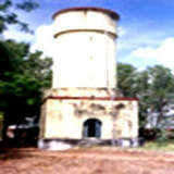
Ramaypatnam Light, from which a radiobeacon transmits, is shown from a hexagonal concrete tower lying on the coast 0.8 mile NE of the church at Ramaypatnam, built in 1870, that served as a land mark for the benefit of ships cruising off the Ramaypatnam coast. The Lighthouse Tower ...
The Lighthouse station is separated from Pulicat town by a sea water channel. The town of Pulicat lies on an island at the S end of Pulicat Lake and is visible from the offing. A tall conspicuous monument lies close N of the lighthouse near the beach. The lighthouse at this ...


 Shallinger Shoal, a spit with depths of 3.2 to 4.6m, extends about 2.5 miles NE from the coast, 7.5 miles N of the mouth of the Upputeru River. A detached 5.5m patch lies 1.5 miles S of the NE extremity of Shallinger Shoal.