Starogradski Zaljev Hvar
There are several bays, including its N side, where it is possible to anchor. On the other side there is an anchor in front Gradisce.
| Latitude | Longitude | |
| DMS | --- | --- |
| DM | --- | --- |
| DD | --- | --- |


 canal 17


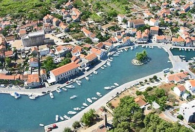
 Vrboska is a town and inlet on the northern side of the island of
Hvar situated at the end of the long and narrow inlet.
Vrboska is a town and inlet on the northern side of the island of
Hvar situated at the end of the long and narrow inlet.When approaching
from north the island of Zečevo can be used as a landmark. On Zečevo
there is a lighthouse.
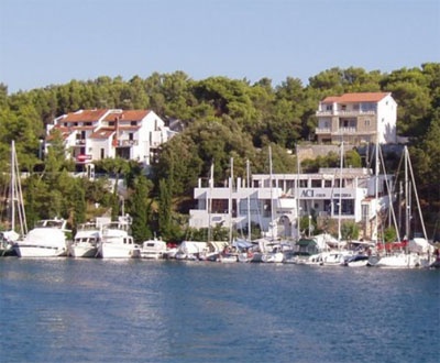
After rounding Glavica Peninsula, ACI
marina Vrboska comes in sight. At night one should steer towards the red
lighthouse which marks the entrance of the harbor of
Jelsa. When the lighthouse on Cape Križ comes in sight,
the lights of ACI marina Vrboska will be visible as well.
Those who
approach from the south will reach the marina by following the eastern
coast of the island of Hvar. At night they will see all three above
mentioned lighthouses. The ACI piers are lighted as well.
The marina is
well protected from all winds.
84 B.
25 boat places on land.
Tel: +385 (0)21 77 40 18
Fax. +385 (0)21 77 41 44
Mail: m.vrboska@aci-club.hr
We can anchor in one of the handles located at N and S of the entrance Vrboska.

 Vrboska est une ville, au N de O. Hvar, située au fond d'une anse longue et étroite bien abritée sauf du SE.
Lorsque vous vous approchez par le N, l'île de Zecevo peut être utilisée comme un point de repère. Sur Zecevo il y a un phare. Après avoir contourné la péninsule Glavica, ACI marina Vrboska est en vue. La nuit, on devrait s'orienter vers le phare rouge qui marque l'entrée du port de Jelsa. Lorsque le phare du Cap Križ est en vue, les lumières de la marina ACI Vrboska seront aussi visibles.
Ceux qui approche par le sud vont atteindre le port de plaisance en suivant la côte orientale de l'île de Hvar. La nuit, ils verront les trois phares mentionnés ci-dessus . Les pontons de l'ACI sont éclairés.
La marina est bien protégée de tous les vents.
84 pl.
25 pl. à sec
Tel: +385 (0)21 77 40 18
Fax. +385 (0)21 77 41 44
Mail: m.vrboska@aci-club.hr
On peut mouiller dans l'une des anses situées au N et au S de l'entrée de Vrboska.


Ebook | Splitsko-dalmatinska županija (Split-Dalmatia Coun
|


