Pulau Kepulauan Singkeplaut (SE Pulau Singkeplaut)
21nm
19°
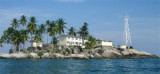
A conspicuous tree is reported to stand on Pulau Singkeplaut.
26 Feb 12
Jojo
| Latitude | Longitude | |
| DMS | --- | --- |
| DM | --- | --- |
| DD | --- | --- |


 Tanjung Jabung (Djaboong), the SW limit of the Inner Route (N Singapore Strait from Selat Bangka via Selat Berhala and Selat Durian), is conspicious and partly overgrown with trees.
A light is shown from Tanjung Jabung.
From Tanjung Jabung, the coast of Sumatera trends sharply to the W, forming the delta of the Djambi River and Djambi Bay. This coast is fronted by a mud bank which in places extends 5 miles off.
Depths of 5.5m and 5.9m lie as far as 12 miles SE and 13 miles SSE of Tanjung Jabung, in positions as far as 6.75 miles offshore. A 10.1m patch lies 7 miles NE of the same point.
Caution.—A wreck, with 6.9m, and a wreck, with 9.6m, lie 5.75 and 10 miles ENE, respectively, of Tanjung Jabung; numerous dangerous wrecks, best seen on the chart, exists SE of the same point.
Ebook | Sumatra (Indonesia)
|