Punta Pichalo (Tarapaca Chile)
1.1nm
251°
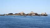
There are a number of hummocks on the ridge. A conspicuous antenna stands on the ridge about 0.5 mile E of the point. A light ...
13 Dec 12
Joëlle
| Latitude | Longitude | |
| DMS | --- | --- |
| DM | --- | --- |
| DD | --- | --- |


 Pisaqua bay is located between Punta Pichalo and NE Punta Pisaga, at about 2,8 NM. The shore bank, with several islets on it, follows close along the shores of the bay. Roca Cooke, Roca Carbonera, Banco Nuevo, and Roca Osorio are dangers lying close off the shore bank and not more than 0.2 mile offshore.
Depths of 44 to 104m in the entrance of the bay decrease gradually to 14.6 to 46m within 0.3 mile of the shore. Wrecks lie about 1.3 miles E by N, and 2 miles NE of Punta Pichalo.
The town of Pisagua is situated on a hillside on the SE shore of Bahia de Pisagua.
A small pier, in poor condition, with a depth of 2.7m alongside, is situated on the S shore of the bay. A light is shown from the head of the pier. A pier, 70m long with a depth of 9m at its head, is situated at the head of the bay.
Anchorage is available, in a depth of 18m, with the pier on the S shore of the bay.
The bay is exposed to frequent heavy gusts of wind from SE through S to SW.
The shore bank is steep-to and precautions should be taken to prevent dragging off it.
 La Baie de Pisagua se trouve entre Punta Pichalo et à environ 2,8 MN au NE de Punta Pisaga. Cette grande baie est bordée de plusieurs îlots le long de la rive (Roca Cooke, Roca Carbonera, Banco Nuevo et Roca Osorio), à environ 0,2 MN au large de la côte.
Les profondeurs, de 44 m à 104 m à l'entrée de la baie, baissent progressivement de 46 m à 14,6 m à moins de 0,3 MN de la côte.
La ville de Pisagua est située sur une colline sur la rive SE de la baie.
Un petit quai en mauvais état, avec une profondeur de 2,7m, se trouve sur la rive S de la baie. Une jetée de 70 m de long, avec une profondeur de 9 m à son extrémité et un feu de musoir, se trouve à l'entrée de la baie.
On peut s'amarrer au quai, par 18 m, sur la rive S de la baie.
La baie est exposée à de fréquentes fortes rafales de vent de SE.
Le rivage est accore et il faut prendre des précautions pour ne pas s'en approcher
Ebook | Chile
|
")
")