Otok Zirje (Sibenik)
It is long of 6,5 NM (NW/SE) and 1,4 NM wide.
The main village, Zirje, is located in the middle of the island. A small port, luka Muna, on the coast N of Zirje, home to the ferry that connects the ...
| Latitude | Longitude | |
| DMS | --- | --- |
| DM | --- | --- |
| DD | --- | --- |

 au poste de carburant


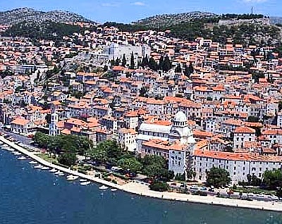
 The town of Sibenik is located 2 NM inland across from kanal Sv Ante which connects to the sea is a major trading port that offers only a platform exposed to boaters.
The dock is sheltered only from the N and E.
Sibenik is a permanent port of entry.
Tel: +385 22 213 033
Fax: +385 22 212 133
Mail: luka@lukasibenik.hr
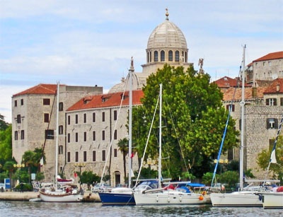
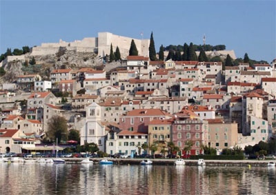
Sibenik, founded in the tenth century at the edge of a deep bay, was a short period the Croatian capital of the Kingdom. The historic center of the old town, with winding streets and fortress which dominates Sainte Anne, are its main attractions.
Its real cultural treasure is the cathedral St Jacques, built between 1431 and 1535 by Italian artisans and Dalmatian in Gothic and Renaissance styles.
Its unique beauty and harmony to its being listed as World Cultural Heritage by UNESCO.

 La ville de Sibenik se trouve à 2 NM à l'intérieur des terres en face du kanal Sv Ante qui la relie à la mer. C'est un grand port de commerce qui offre seulement un quai exposé aux plaisanciers.
On s'amarre le long du quai, au SE du poste de carburant ou près de la capitainerie.
Le quai est abrité seulement du N et de l'E.
Sibenik est un port d'entrée permanent.
Tel: +385 22 213 033
Fax: +385 22 212 133
Mail: luka@lukasibenik.hr
Sibenik, fondée au Xe siècle au bord d’une baie
profonde, fut sur une courte période la capitale du Royaume Croate. Le
centre historique de la vieille ville, aux ruelles tortueuses et la
forteresse Sainte Anne qui la domine, sont ses principales attractions.
Son vrai trésor culturel est la cathédrale St Jacques, construite entre
1431 et 1535 par des artisans italiens et dalmates, en styles gothique
et Renaissance.
Sa beauté unique et son harmonie lui valent d’être
inscrite sur la liste du Patrimoine Culturel Mondial de l’UNESCO.


Ebook | Šibensko-kninska županija (Šibenik-Knin County)
|


