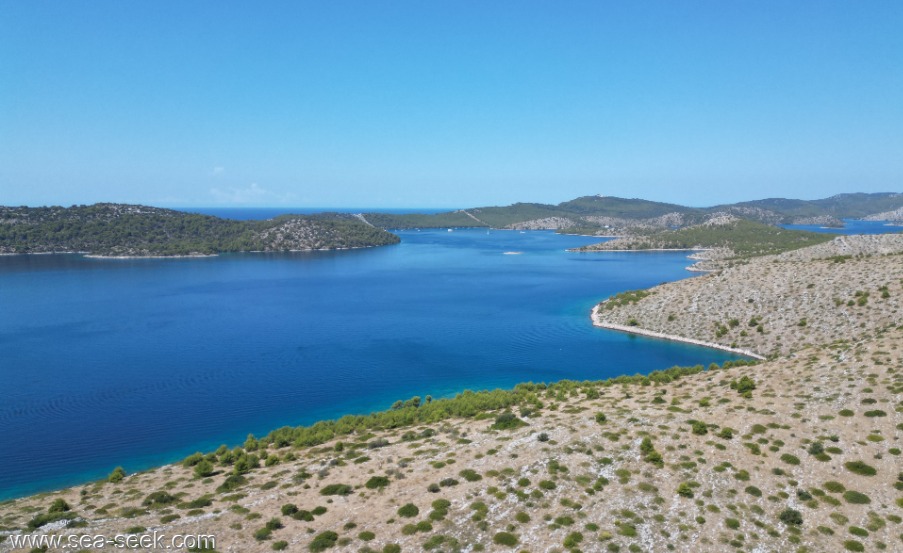
Luka Telascica (Dugi O.)

Luka Telascica (Dugi O.)

To precisely geolocate this site. Update if necessary.

Localisation

Characteristics

Mooring
Sand
Diving
Natural Park

Description

Telascica est une baie d'une longueur de 10 km qui jusqu'à 1988 fût la partie principale de Parc national de Kornati. Aujourd'hui c'est le Parc naturel sur la côte du sud-est de l'île de Dugi Otok avec le point le plus haut surnommé Grpascak à 161 m d'altitude et avec du lac salé de Mir.
Telascica est l'une des baies les plus belles et les plus grandes sur l'Adriatique. Cette baie est entourée de 13 îles et îlots. Au centre de la baie il y a encore 6 îlots. Telascica est connue comme l'abri protégé pour tous les types des bateaux. Le côté du nord-est est complètement dépouillé, sans flore et la partie du sud-ouest est couverte de la forêt luxuriante de pin, des oliviers et des figuiers.
La baie de Telascica est peuplée de l'antiquité. Les falaises raides, qui s'allongent jusqu'à 166 m d'altitude, protègent la baie de tous les vents.
Ce grand port naturel est divisé en 4 bassins et offre plusieurs mouillages. Des gardes font le tour des mouillages en bateaux pour récolter la taxe de séjour et les ordures. cette taxe donne droit à une journée et une nuit dans le parc national des îles Kornati.
Le parc abonde en végétation méditerranéenne avec plus de 400 espèces de végétaux. Il y en a aussi de nombreux animaux. Dans la mer vit d'environ 250 espèces de végétaux et 300 espèces d'animaux avec incluse éponge et le corail rouge qui est très rare.
2008/09/7
Update
Luka Telascica (Dugi O.)
2008-09-07
Update
Luka Telascica (Dugi O.)
2008-09-07
Update
Ebook

Zadarska županija (Zadar county)

  • 95 sites
  • 136 photos
  • publication date: 6 Aug 2024
  • .pdf file size: 52 Mb
Luka Telascica (Dugi O.)
AB
2024
2024-07-24
Update
Share your comments or photos on "Luka Telascica (Dugi O.)"

Sites around Luka Telascica (Dugi O.)

Flying distances - Direct line

Kanal Nove Povljane Vir

24nm
355°
Kanal Nove Povljane, entered between Otok Vir and the SE end of Otok Pag, leads 5 miles SE into Ninski Zaliv.
Shoals at the inner end of this channel restrict the fairway to a width of about 250m, with a controlling depth of 8m. Vessels with a draft of over 6m are advised not to ...
23 Jul 11
Jojo

Rivanjski Kanal

15nm
337°
Rivanjski Kanal continues NW from the N end of Srednji Kanal and leads between Otok Rivanj andOtok Sestrunj.
It is generally used by vessels proceeding between Srednji and Zadarski Kanals.
Otocic Tri Sestrice, a group of islets and rocks, extend up to 2 miles NW of Rt Zanavin, ...
9 Sep 11
Jojo

Otok Vir

23nm
352°
The island of Vir is one of the 300 islands of Zadar archipelago.
Vir island is located SW Pag, it is 25 kilometers north of Zadar and it has an area of 22.38 square kilometers. It rises gently from the sea to a bare and double summit, (Bandira) 112m high, with reminds of fort.
A ...
22 Jul 11
Jojo

Otok Murter

21nm
109°
The island of Murter is the largest island of the Sibenik archipelago. It is close to the coast on which it is connected by a bridge, low air draft at Tijesno (Tisno) on the continent. During the summer the bridge opens to allow passage of boats.
The NW part of the island is fertile ...
3 Apr 11
Jojo

Ninsko Ljubacki Kanal Zadar

22nm
Ninsko-Ljubacki Kanal, a tortuous channel, connects the SE end of Kanal Nove Povljane with Ljubacka Vrata. This channel leads through the deep inlets which indent the SE coast of Otok Pag, on the NW side, and the mainland, on the SE side.
It is entered between Rt Prutna,which is ...
23 Jul 11
Jojo

Vrgadski Kanal

17nm
102°
Vrgadski Kanal, 7 miles long, leads between Otok Murter and Otok Vrgada and is the principal channel used in the S approach to Pasmanski Kanal and Zadar.
Vessels with a maximum draft of 6.4m may pass through Pasmanski Kanal. Vessels with drafts over 6.4m must either proceed through ...
16 Jul 11
Jojo