Luka Polace Mljet

Luka Polace Mljet

To precisely geolocate this site. Update if necessary.

Localisation

Characteristics

Port
Mud
Mooring
Water robinet au S du château
Grocery
Bakery
Restaurant

Description

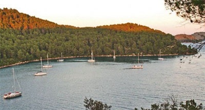
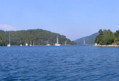
On the NW coast of Mljet luka Polace, the small village of Polace is located at the bottom of a long inlet protected by a few wooded islands and islets (O. Skoljic, O. Moracnik, O. Ovrata, and O. Tajnik Kobrava ) uninhabited. This is one of the most sheltered anchorage in the region.
Approaching from the E or SE, the main entrance is between O. Mljet and O. Kobrava. The fire Hrid Kula, a rocky island located roughly halfway between Mljet and O. Kobrava, identifies the entry.
Skip to N. Hrid of Kula.
Approaching from the N or W, attention to the rock outcropping located northeast of the island at the entrance of uvala Porat. When you come from that direction, the entrance channel in Polace Luka is between O. Mljet and O. Moracnik. Attention, O. Skoljic (islet at the entrance) has a rocky shallow extending towards the west. Skip to the W O. Skoljic, then stay in the middle of the fairway.
A low point extending eastward into the channel, it is a rocky bank which emerged only a few centimeters. Just SE of this point, there is a rock near Moracnik, but it is covered by 5.5 m.
Can pass between the islands of Ko and Ovrata and brava. There is no danger in this approach.
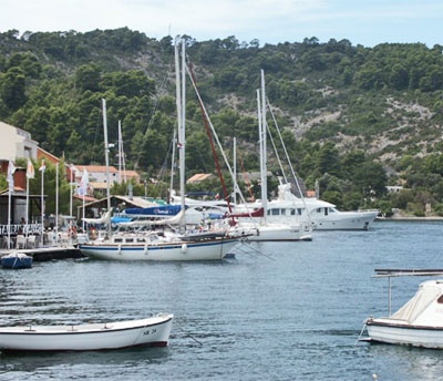
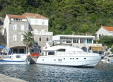
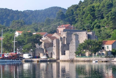
Can moor at the wharf near the castle, away from the location of the Ferry. The dock at the E Ferry is reserved for restaurants.
You can anchor in the N bay where the best shelter.
In season, a right anchor is perceived.
You can anchor on the coast S O. Kobrava.
Very good protection from all winds.
2011/05/6
Update
Jojo
Luka Polace Mljet
2011-05-06
Update
Jojo
Sur la côte NW de Mljet luka Polace, le petit village de Polace est situé au fond d'un long bras de mer protégé par quelques îles boisées et îlots (O. Skoljic,  O. Moracnik, O. Ovrata, Tajnik et O. Kobrava), inhabitées. C'est l'un des mouillage les plus abrités de cette région.

En approchant par l'E ou le SE, l'entrée principale se trouve entre O. Mljet et O. Kobrava. Le feu de Hrid Kula, un îlot rocheux situé à peu près à mi-chemin entre Mljet et O. Kobrava, permet d'identifier l'entrée.

Passer au N. d'Hrid Kula.
En approchant par le N ou l'W, attention au rocher affleurant situé au NE de l'île à l'entrée d'uvala Porat. Quand on arrive de cette direction, le chenal d'entrée dans Luka Polace se trouve entre O. Mljet et O. Moracnik. Attention, O. Skoljic (îlot à l'entrée) a une avancée rocheuse peu profonde s'étendant vers l'W. Passer à l'W d'O. Skoljic, puis rester au milieu du chenal.
Une pointe basse s'étend vers l'E dans le chenal, c'est un banc rocheux qui n'émerge que de quelques centimètres. Juste au SE de cette pointe, il y a un rocher près de Moracnik, mais il est couvert par 5,5 m.

On peut passer entre les îles Ovrata et et de Ko brava. Il n'y a pas de danger dans cette approche.

On peut s'amarrer au quai près du château, à l'écart de l'emplacement du Ferry. Le quai à l'E du Ferry est réservé aux restaurants.

On peut mouiller dans la partie N de la baie où se trouvent le meilleur abri.
En saison, un droit de mouillage est perçu.

On peut mouiller sur la côte S d'O. Kobrava.

Très bonne protection de tous les vents.
2011/05/6
Update
Jojo
Luka Polace Mljet
2011-05-06
Update
Jojo
Luka Polace Mljet
2011-05-06
Update
Jojo
Luka Polace Mljet
2011-05-06
Update
Jojo
Ebook

Dubrovačko-neretvanska županija (Dubrovnik–Neretva

  • 140 sites
  • 228 photos
  • publication date: 6 Aug 2024
  • .pdf file size: 79 Mb
Ebook

Dalmacija (Dalmatie)

  • 568 sites
  • 963 photos
  • publication date: 5 Aug 2024
  • .pdf file size: 350 Mb
Share your comments or photos on "Luka Polace Mljet"

Sites around Luka Polace Mljet

Flying distances - Direct line

Otok Sipan

22nm
99°
It is the largest and most populated island of the group Elafiten. It rises to 234 m at its N and a prominent hill rises 224 m NW of the SE end.
Ruda is a small island that is 0.5 M SE of the NE extremity of the island and Misnjaka, 13 m high, lies close off the NW extremity.
...
16 Apr 11
Jojo

Stonski Kanal

15nm
85°
Stonski Kanal, a deep inlet, indents the SE end of Poluotok Peljesac at the NW end of Kolocepski Kanal.
Its shore rises rapidly on each side and provides protection from NE and SW winds. The village of Brocej is situated on the S shore 3.8 miles within the entrance.
It is fronted ...
25 Apr 11
Jojo

Zaliv Klek Neum

12nm
46°
The narrow sea from Zaliv Klek Neum is 4 NM long and lies at the NE channel Malog Stone. It is surrounded by mountains and is inserted between Rt Rep Kleka and Rt Meded.
Depths exceeding 20 meters in most cases. There are several anchorages.
The SE part and W peninsula ...
3 May 11
Jojo

Luka Pomena Mljet

1.5nm
272°
Located at the NW end of Mljet this port is the most touristy.
Approaching Luka Pomena by E or N, attention to the rock outcropping NE of the small island at the entrance to Uvala Stupa, located at N Pomena.
We can go on both sides of O. Glavat, but attention to two islets in ...
9 May 11
Jojo

Luka Kozarica Miljet

3.8nm
99°
Kozarica is one of the oldest settlements on the island which is located at the foot hills of the Great and Small town (big city-the highest peak on the island).There is a small port, unfrequented by boaters, located 1.4 NM ESE Hrid Kula (at the entrance of luka Polace). There is ...
8 May 11
Jojo

Trstenik Peljesac

7.8nm
The Trstenik port is located at N  Zaton Zuljana at the bottom of a hill covered with vines.
The breakwater Trstenik has a fire at its end (metal painted in red). A chapel is located across from the breakwater.
We moore on to the breakwater or pier or anchored in the middle ...
5 May 14