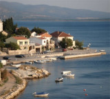
Nosko Zdrilo (Maslenicki Kanal) Zadar

Nosko Zdrilo (Maslenicki Kanal) Zadar

To precisely geolocate this site. Update if necessary.

Localisation

Characteristics

Sea
Canal

Description

Nosko Zdrilo (Maslenicki Kanal) is entered at the N end between Rt Baljenica, a conspicuous brown and yellowish point, and Rt Korotanja, 0.2 mile SW.

These entrance points are fringed by shoals which are marked by buoys.
The fairway of the entrance has a least depth of 7.9m. The channel is 2 miles long and has a minimum width of 200m with depths of 18 to 33m.

Generally, vessels up to 140m in length and 7.9m draft can transit the passage.

Pilotage is compulsory for foreign vessels over 500 grt through Novsko Zdrilo. Pilots are available, with advance notice, from Zadar and will board in daylight only outside the entrance to the channel.
It has been reported (1994) that passage through Novsko Zdrilo is prohibited to all vessels. Vessels should contact the authorities at Zadar for the latest information concerning transit through this channel.
A new bridge, with a vertical clearance of 77m, now spans the S end of the channel.
2011/07/23
Update
Jojo
Nosko Zdrilo (Maslenicki Kanal) Zadar
2011-07-23
Update
Jojo
Nosko Zdrilo (Maslenicki Kanal) se trouve à l'extrémité N entre RT Baljenica, un remarquable point brun et jaunâtre, et Rt Korotanja, 0,2 mile au SW.
Ces points d'entrée sont bordée par des bancs qui sont marqués par des bouées.
Le chenal d'entrée a une profondeur minimale de 7,9 m. Le canal est long de 2 NM et a une largeur minimale de 200 m avec des profondeurs de 18 à 33m.
Généralement, les navires jusqu'à 140m de longueur et 7,9 m de TE peuvent prendre le passage.
Le pilotage est obligatoire pour les navires étrangers de plus de 500 tjb. Les pilotes sont disponibles, avec un préavis, à partir de Zadar et monteront à bord en plein jour seulement à l'extérieur de l'entrée du canal.
Il a été rapporté (1994) que le passage par Novsko Zdrilo est interdit à tous les navires. Les navires doivent contacter les autorités à Zadar pour les dernières informations concernant le transit par ce canal.
Un nouveau pont, avec une hauteur de 77m, s'étend maintenant sur l'extrémité S du chenal.
2011/07/23
Update
Jojo
Ebook

Šibensko-kninska županija (Šibenik-Knin County)

  • 101 sites
  • 188 photos
  • publication date: 8 Aug 2024
  • .pdf file size: 65 Mb
Ebook

Dalmacija (Dalmatie)

  • 568 sites
  • 963 photos
  • publication date: 5 Aug 2024
  • .pdf file size: 350 Mb
Share your comments or photos on "Nosko Zdrilo (Maslenicki Kanal) Zadar"

Sites around Nosko Zdrilo (Maslenicki Kanal) Zadar

Flying distances - Direct line

Novigradsko More

2.3nm
167°
Novigradsko More, a landlocked bay, lies at the S end of Novsko Zdrilo and provides good anchorage.
Rijeka Zrmanja flows into the bay at the E side. This river is navigable by small craft as far as the village of Obrovca, 6 miles above the mouth.
Luka Novigrad, a narrow inlet, ...
23 Jul 11
Jojo

Kanal Nove Povljane Vir

19nm
286°
Kanal Nove Povljane, entered between Otok Vir and the SE end of Otok Pag, leads 5 miles SE into Ninski Zaliv.
Shoals at the inner end of this channel restrict the fairway to a width of about 250m, with a controlling depth of 8m. Vessels with a draft of over 6m are advised not to ...
23 Jul 11
Jojo

Vrgadski Kanal

22nm
179°
Vrgadski Kanal, 7 miles long, leads between Otok Murter and Otok Vrgada and is the principal channel used in the S approach to Pasmanski Kanal and Zadar.
Vessels with a maximum draft of 6.4m may pass through Pasmanski Kanal. Vessels with drafts over 6.4m must either proceed through ...
16 Jul 11
Jojo

Ninsko Ljubacki Kanal Zadar

14nm
285°
Ninsko-Ljubacki Kanal, a tortuous channel, connects the SE end of Kanal Nove Povljane with Ljubacka Vrata. This channel leads through the deep inlets which indent the SE coast of Otok Pag, on the NW side, and the mainland, on the SE side.
It is entered between Rt Prutna,which is ...
23 Jul 11
Jojo

Otok Zirje (Sibenik)

35nm
169°
Otok Zirje is the farthest and the largest island in the Sibenik archipelago.
It is long of 6,5 NM (NW/SE) and 1,4 NM wide.
The main village, Zirje, is located in the middle of the island. A small port, luka Muna, on the coast N of Zirje, home to the ferry that connects the ...
16 Aug 11
Croatia

Luka Maslenica Solta

0.8nm
154°
On the W coast of O. Solta Maslinica is a small village and a small port. Located NE of the S of Novsko Zdrilo, the platform is used to load the bauxite.
The wharf is 120 m long and has a depth of 10 m alongside.
Good protection from all directions.
23 Jul 11
Jojo